Popular games published by company France Image Logiciel

The first game in the Beach Head series, the game depicts the player's violent war effort to end a dictator's reign

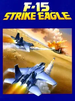
F-15 Strike Eagle is an F-15 Strike Eagle combat flight simulator first released in 1985 by MicroProse. It is the first in the F-15 Strike Eagle series comprising also the sequels F-15 Strike Eagle II and F-15 Strike Eagle III.

The new version of Yie Ar Kung Fu!! Even more thrills and suspense!

Threshold is a typical shoot 'em up that places the player's spaceship at the bottom of the screen where he has to fend of the enemy. If the player misses an enemy and he reaches the opposite side of the screen he will reappear on the other side of the screen again. This goes on as long as the player has destroyed all enemy ships and the game progresses into the next stage with enemies approaching in a different attack pattern. Needless to say that contact with an enemy projectile or an enemy itself results in losing a life.

Top Gun is a 1986 combat flight simulation game based on the film of the same name. It was developed and published by British company Ocean Software, and was released for several computer platforms. In the United Kingdom, it was released for Amstrad CPC, Commodore 64, and ZX Spectrum in December 1986. The following year, it was released for Atari ST. In the United States, it was published by Thunder Mountain. In 1989, it was published by The Hit Squad as a budget re-release for ZX Spectrum and Commodore 64.

Solo Flight is a flight simulator game for the Commodore 64, Atari 8-bit family, and Apple II series released in 1983. It was later released for the IBM PC. The game was created by noted game designer Sid Meier, and published by MicroProse Software, which Meier founded in 1982 with Bill Stealey. The mission of the game is to fly solo over several states, delivering bags of mail. The game supported a fairly realistic flight model (for the time), and a large number of flight instruments were available. A map covering many states of the US was used, which even included altitude data (although the landscape always appeared flat due to the technology constraints of the time).